Day: 2
Trajectory: Esquel – Trevelin – Los Alerces National Park – Cholila – Leleque – Esquel.
Distance covered: 317 km

La Hostería El Arrayan in Esquel, where we stayed for nights one and two.
We were up earlyish for coffee and toast and jam. Today was to be a quieter day, spent on a side trip around Esquel. More of a circular trip really, as we drove in a large loop ending where we started up.

Entering Trevelîn, a growing town that still sports its Welsh heritage
Our first port of call was the nearby town of Trevelín, the town of the mill, founded by Welsh settlers in 1889. Here we had morning coffee with Clare Vaughan, coordinator of a British Council run Welsh teaching project across the Welsh belt of Central Patagonia before moving on. Clare’s work interests me very much, and having made contact we have arranged to meet again on my return journey.

Tis and jeep, outside Bar El Único, where we met Clare. This was the first school in Trevelín
We left Trevelín to drive through the immense Los Alerces National Park with its beautiful trees and views, and skirted a number of lakes. We passed through all weathers in the three hours or so it too us to drive through the Park with bright sun, rain and heavy snow.

Entrance to the Los Alerces National Park
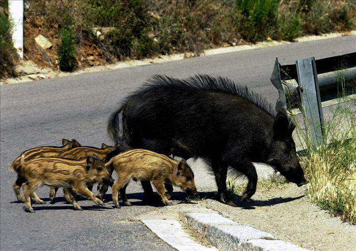
The park was brimming with wildlife –we saw and heard an extensive variety of birds– and had a number of trails leading to waterfalls, panoramic viewpoints, etc. The roads were mostly well surfaced, with a little work still to do in parts, but a far cry from the last time I drove this road in the early 1980s.

Waterfall in the Los Alerces National Park ….
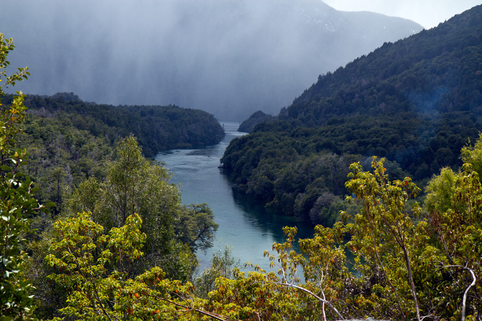
… and a viw over a ‘brazo’ of one of the lakes we passed
Not all the animals we saw were wild; the park was also full of sheep, horses and cattle, the last of which fascinated Tiso who shot half of his photographic allowance on some cows in his bid for the ‘animal of the day’.
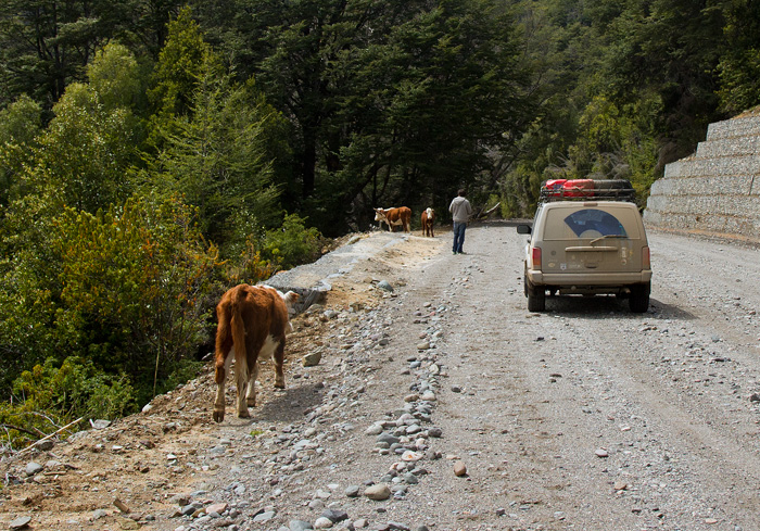
Tiso took a particular interest in the cows – these were friendly and unproblematic …

… while others were not quite as welcome, though we were in no hurry
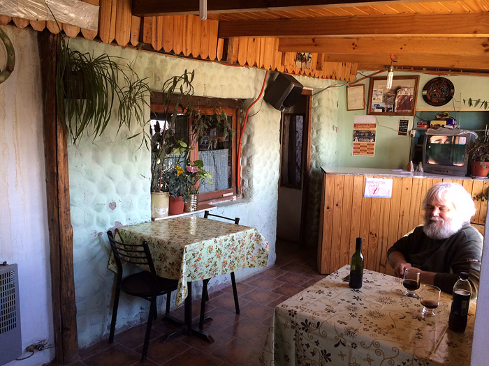
We came out of the National Park in time for a late lunch at Cholila, founded in 1840 but which has never really taken off and we wondered what work there would be to keep the small population there. We enjoyed a good, filling and reasonably economic lunch at Lily’s Kitchen.
")
Lily’s Kitchen – our choice of places to eat in Cholila (not that we actually had much of a choice!)
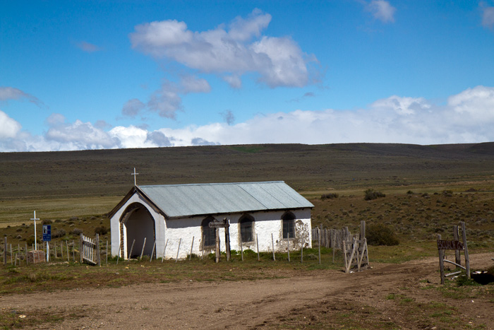
Bellies full once more, we set off for Butch Cassidy’s ranch some eight kilometres outside Cholila, passing on the way a small but atmospheric cemetery – a well-cared for reminder of the first settlers in the area.

First cemetery of early settlers in the outskirts of Cholila
Much has been written about Butch Cassidy, and since the 1969 movie and Chatwin’s book In Patagonia interest in him and his ‘gang’ has grown, making his ranch outside Cholila a shrine for western fans. Sadly, much that has been written about him is distorted or just plain wrong, but in this case he really did live at this ranch with the Sundance Kid and the enigmatic Etta Place.

Butch Cassidy’s cabin homestead some 8 km outside Cholila …
The cabin and two outhouses have recently been restored, and the cabin is accessible, containing three rooms and a surprising number of doors. No inside fireplace (and it was bitterly cold on the day of our visit). We were able to enter, and Tiso took my picture sitting inside: a great memento!

Sitting in one of the three rooms inside the [restored] Butch Cassidy Cabaña
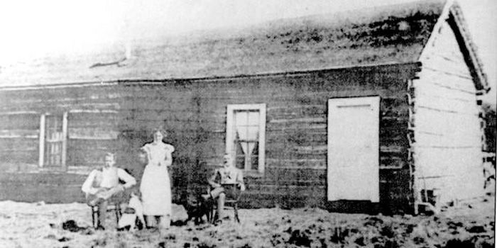
Butch Cassidy, Etta Place and the Sundance Kid (right to left) in front of their ranch cabin in Cholila, Argentina, sometime between 1901-1905.
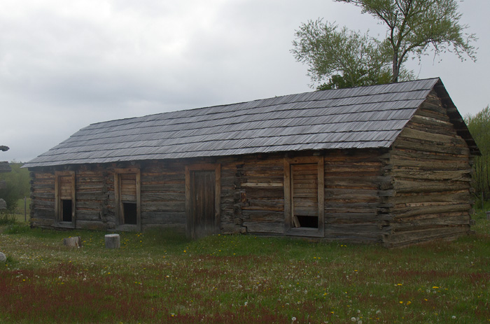
The cabaña today, renovated but in the same place
We left the homestead happy with having made the trip to visit it, and happy too that we had the place all to ourselves to drink up some of the atmosphere. In the height of the tourist season –and there are signs that the site is being developed for that purpose– it would have lost much of its atmosphere.
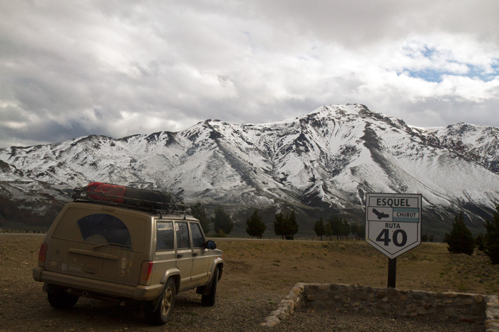
After a long day’s drive we return to Esquel
We set off for Leleque and the RN4O back to Esquel; the same last bit of the route as yesterday and the same destination. Tomorrow we set off south, to Perito Moreno. But more anon.


, when we walked from the hot springs at Epulafquen to the camping site at Piedra Mala (Paimún).")


 near the town of Perito Moreno in the province of Santa Cruz. Photo from www.patagonia.com.ar/.")

 of the Ruta 40 in cabo Virgenes. Not the end of the trip though - we go further south. Photo http://www.turismoruta40.com.ar")
